Temperature Dashboard®
The Only Tool You’ll Ever Need for Urban Temperature Planning
Temperature Dashboard Features
®
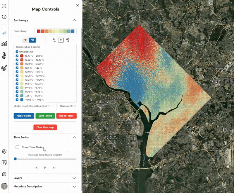
Heat Map Generation
Our engine generates high-resolution heat maps across three temporal modes:
-
Historic: Analyze past temperature patterns to identify long-term urban heat trends.
-
Near Real-Time: Monitor current urban heat conditions with minimal latency.
-
Predictive: Leverage AI to forecast future heat distribution across urban surfaces, helping with proactive planning and heat risk mitigation.
Heat Map Comparison
Instantly compare two heat maps side-by-side within the same geographic boundary and resolution. Users can analyze how heat varies across different times—before and after interventions, across weather shifts, or between daily extremes—enabling data-backed decision-making and impact assessments.

Heat Map Time Series
Explore how temperature patterns evolve across hours, days, or months. The time series tool lets users “play” through a dynamic sequence of heat maps, observing how thermal behavior shifts over time. Ideal for assessing urban heat islands, cooling cycles, and identifying patterns critical to energy and public health planning.
Analytics
Turn heatmaps into actionable intelligence. Our analytics engine uncovers the why behind the what—revealing the drivers, patterns, and consequences of urban heat through layered data, statistical tools, and real-world context.
Environmental Parameters
Go beyond heat by accessing a suite of climate-adjacent metrics, including:
-
Heat Index
-
Wet Bulb & Apparent Temperature
-
Precipitation & Snowfall
-
Air Quality Index (AQI)
-
Solar Irradiance (GHI, DNI, DHI)
These layers provide rich context for understanding not just how hot it is, but why, and how surrounding conditions amplify or mitigate thermal risks.

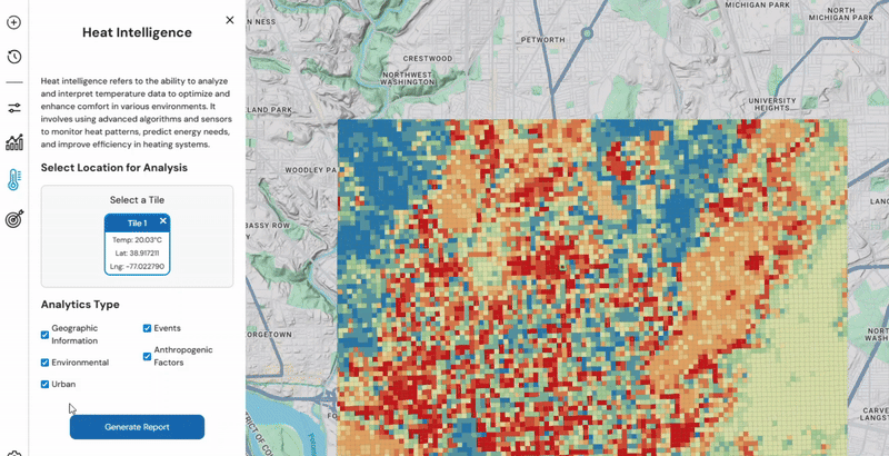
Heat Intelligence Reports
Tap a tile on the heatmap to unlock deep insights into that exact location. Each Heat Intelligence Report combines temperature data with 5 contextual layers:
-
Geographic Information
-
Events
-
Environmental Factors
-
Urban Attributes
-
Human Activity (Anthropogenic Influences)
This feature enables hyperlocal decision-making and site-specific urban planning, merging data science with real-world impact.
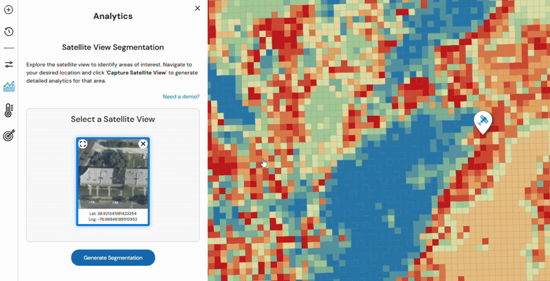
Segmentations
Understand the urban environment through high-resolution visual intelligence. Our segmentation analytics module classifies the built environment into meaningful components that drive heat dynamics, using both satellite and street-level data to offer a complete view.
Satellite Segmentation
Gain a bird’s-eye view of your city’s thermal landscape. Satellite segmentation analyzes overhead imagery to detect and classify features like buildings, roads, vegetation, sky, and water bodies. This top-down perspective helps users assess how land cover and surface materials contribute to heat absorption and retention—essential for macro-scale interventions, zoning analysis, and urban morphology studies.
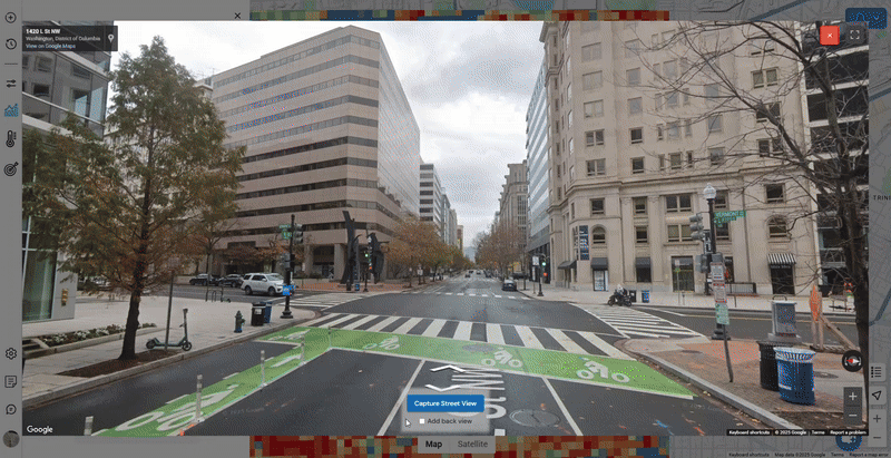
Street View Segmentation
Zoom in to ground-level reality. Using front and rear-facing imagery, street view segmentation identifies the same key urban elements from a human perspective. This street-level analysis captures how people actually experience heat, accounting for building height, vegetation shading, material textures, and street geometry. Observational commentary provides additional context, allowing planners to make microclimate-sensitive decisions grounded in the lived experience of heat.