Asset owners and operators
Rank sites by local heat exposure and keep an eye on the assets that run hot.
 ☰
Temperature Enterprise
One recurring agreement brings together Temperature Dashboard, API, MCP and site thermal simulation, connected to your own asset context and the systems you already use. Each new decision builds on what's already in place.

20 m
Spatial resolution for supported model outputs
2 m
Air-temperature measurement height
Up to 2 weeks
Forecast coverage for supported products
Up to 15 °C
Variation mapped across one square mile in the same hour
52B
Daily network data points available through proprietary access
115×
Accuracy improvement in the approved benchmark
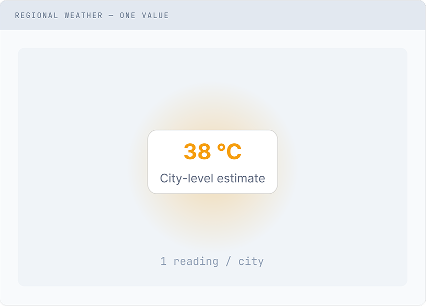
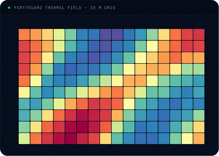
Weather describes the atmosphere around a place. FortyGuard connects those conditions to geometry, materials, terrain, time and asset context, so temperature can inform a physical decision. On one square mile, that means about 6,400 readings on a 20 m grid instead of one, covering past conditions, live conditions and forecasts.
Rank sites by local heat exposure and keep an eye on the assets that run hot.
Test layouts, shade and materials on new or existing sites before construction, then verify the selected design.
Bring local heat, airflow and cooling limits into site selection, design and operation.
Build thermal intelligence into the products your customers already use.
One recurring agreement.
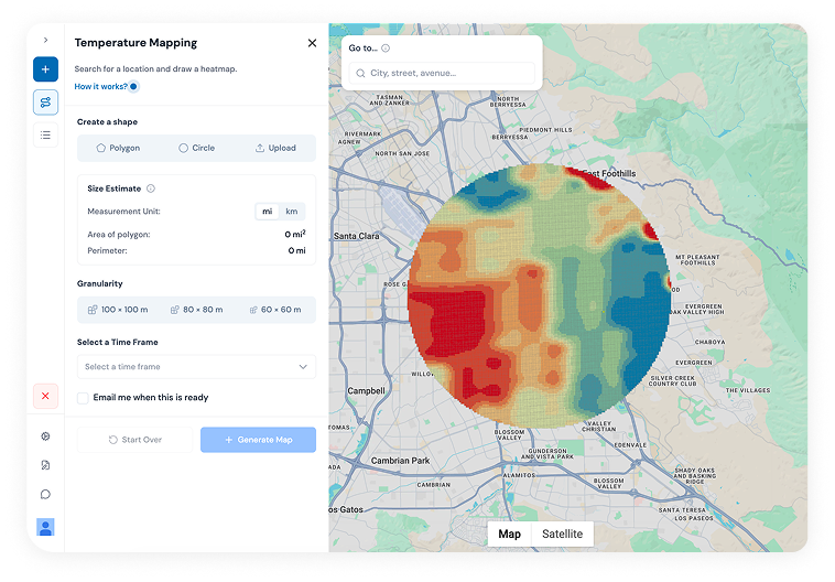
A map first workspace for exploring thermal state, comparing places and producing decision evidence, with Selesious, the agent inside Dashboard.
One allowance shared across your teams and products.
Teams work from the same areas, results and evidence, kept for review.
Your sites, asset geometry and identifiers joined to thermal results and kept for the next decision.
Connections into your GIS, BIM, BMS, DCIM and reporting systems, built once and reused.
Use results in your own products or share them with partners, as agreed.
When a decision needs deeper evidence, FortyGuard separately scopes field measurement, engineering analysis or detailed simulation, then returns the results to your recurring workflow. Separately scoped.
When cost, capacity or comfort priorities change, rerun the loop instead of commissioning a new study.

Step 01
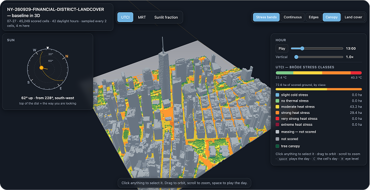
Model how a site or design performs, hour by hour.
Same site, same camera orientation. Each step builds on the previous result — no separate commission needed to advance.
From one-of studies
Where you permit it, measured outcomes like energy use, thermal performance or capacity feed back into the next evaluation.
A new site, a design revision or a portfolio refresh.
Your existing models, data pipelines and integrations are already in place.
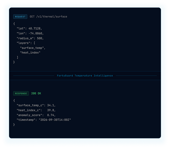
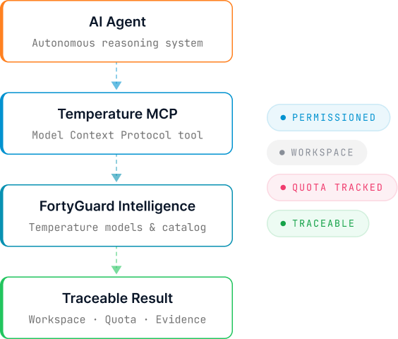
Through Dashboard, API, MCP or your own systems.
Add sites, monitored assets, capacity and workflows to the same agreement.
Foundation — always in place
Model version, source inputs, time, geography and job results stay connected to every output.
Your geometry and operating context are joined to the thermal state, not kept on a separate map.
The same foundation supports browser analysis, software integration, agent use and Enterprise workflows.
Outputs come within defined coverage, model and workflow limits. Your engineers and decision makers keep approval and control.
Three projects where temperature intelligence was applied to actual physical decisions.
100 accepted layouts evaluated.
FortyGuard evaluated 100 accepted masterplan layouts to identify candidates for detailed wind and thermal evaluation, narrowing to 30 eligible designs before final selection.


FAQs
Browse by topic
Temperature Dashboard, API and MCP, site thermal simulation, shared organizational credits, your asset context, reusable integrations and data rights, under one recurring agreement. Specialist verification is scoped separately when a decision needs it.
It works on greenfield sites, where nothing is built yet, and on brownfield sites, where existing buildings and surfaces are being redeveloped. You test a design before construction and compare options while they're still easy to change.
It's one recurring agreement, shaped around your assets, the products your teams use and the systems you need to connect. Talk to us to scope it.
Yes. Talk to us and we'll bring your existing accounts into the agreement.
Yes. Site boundaries, asset geometry, sensor readings and identifiers can be joined to FortyGuard results, so the output fits the records you already keep.
The API delivers into GIS, BIM, BMS, DCIM, asset and reporting systems, and MCP connects your AI agents. Specific integrations are agreed with you.
FortyGuard applies access controls and handles customer data under the applicable product terms and Privacy Policy. Enterprise agreements can define additional security, residency, retention and integration requirements.
Temperature mapping covers the United States today, with data back to 2019. Site thermal simulation runs anywhere a typical year weather file exists.
FortyGuard’s Large Temperature Models, a family of temperature specific models that estimate, downscale and forecast temperature across places and time. Dashboard, API and MCP all draw on the same models.